
Post-Disaster GIS Analysis of the 2025 Flash Floods in Aceh and North Sumatra
- CarbonEthics Indonesia
- Mar 17
- 4 min read

Updated: Mar 30

The Flash flood that affected Aceh and North Sumatra from 24 to 26 November 2025 became a major concern for climate risk disasters in Indonesia. The disaster was driven by meteorological factors such as extreme rainfall and the Senyar Cyclone, and exacerbated by environmental factors, especially deforestation. As a result, about 134,040 hectares were affected in Aceh Utara, Aceh Timur, and Aceh Tamiang. In addition, limited access to mitigation information made it more difficult for communities to respond to the flash flood.
In response to examining the disaster, CarbonEthics develops a GIS post-disaster report as a research study to analyse the spatial, meteorological, and environmental factors that contributed to the flash floods in Aceh and North Sumatra. The report analysis integrates geospatial, meteorological, and environmental datasets from official sources and remote-sensing observations to identify patterns and potential drivers of flooding.
See More: CarbonEthics Presents at First International Young Environmental Scientist (YES) Conference by WRI Indonesia: Enhancing AI-Driven Land Cover Analysis
There are three main objectives of the report: (1) examine spatial drivers of flash floods, including the interaction between extreme rainfall, landscape characteristics, and environmental conditions; (2) verify the occurrence and distribution of flood events using hydrometeorological and remote sensing datasets, including flood extent, flood susceptibility, and satellite-based rainfall observations; (3) evaluates the impacts and levels of exposure to flash floods at the district and city scales.

Overview of the Flash Flood Event
According to flood area distribution data from the Badan Informasi Geospasial (BIG), the total area affected by flooding reached 105,383 hectares in Aceh and 28,657 hectares in North Sumatra. Interestingly, part of the inundated area recorded in 2025 occurred outside the flood-prone zones identified in the 2015 flood vulnerability map produced by BIG. This indicates that flood exposure may evolve over time as environmental conditions, land use patterns, and hydrometeorological factors change.
Flood hazard maps, therefore, play an important role in disaster risk reduction by identifying the level of hazard that needs to be managed in specific locations. In Indonesia, flood hazard assessments developed by Badan Nasional Penanggulangan Bencana (BNPB) serve as an important reference for identifying flood-prone areas. These assessments apply geomorphological analysis and GIS-based terrain modelling to identify inundation zones and assess flood hazard levels across different landscapes.
See more: CarbonEthics Recent Legal Updates
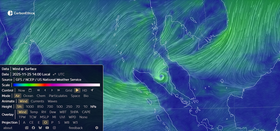
Meteorological Influence: Extreme Rainfall and Tropical Cyclone Senyar
Satellite-based rainfall observations from the Climate Hazards Group InfraRed Precipitation with Station data (CHIRPS) indicate that rainfall intensity exceeded 150 mm/day on 26 November 2025. Additional validation using rainfall measurements from stations operated by Badan Meteorologi, Klimatologi, dan Geofisika (BMKG) shows that rainfall intensity reached approximately 300 mm/day on the same day when interpolated using the Inverse Distance Weighted (IDW) method for the period of 25–27 November 2025.
This extreme rainfall event was associated with the development of Tropical Cyclone Senyar, which influenced atmospheric conditions and contributed to increased moisture convergence over the region. Physiographically, Aceh and North Sumatra are dominated by the Bukit Barisan mountain range, which forms numerous watersheds characterized by relatively short river lengths and steep slopes. Under persistent high-intensity rainfall, these physiographic characteristics can exceed soil infiltration capacity and natural drainage capacity.
As a result, watershed hydrological responses may intensify, increasing surface runoff and contributing to flood and flash-flood events in downstream areas.

Deforestation as an Environmental Factor
Long-term forest cover dynamics may also influence watershed responses to extreme rainfall. Recapitulation of Hansen Global Forest Change data indicates that average forest loss between 2000 and 2024 reached approximately 33,000 hectares per year in Aceh and 22,000 hectares per year in North Sumatra. The data shows fluctuating patterns of forest loss that correspond with periods of intensive land-use activity.
Forest cover loss can influence watershed hydrology by reducing soil infiltration capacity and increasing surface runoff, particularly in steep landscapes with rapid hydrological responses. During extreme rainfall events, increased runoff may also trigger landslides, with sediments accumulating in river channels. This process can lead to riverbed aggradation and channel narrowing, which may influence flood dynamics during high-flow conditions.
Through this findings highlight how extreme weather conditions and environmental sensitivity can interact to shape flood risk, emphasising the need for dynamic flood hazard mapping and improved spatial risk assessment. Furthermore, the report aims to support understanding of disaster risk and long-term climate resilience planning.
Flood Impact Conditions (Zoom-in Analysis)

Satellite imagery analysis using Sentinel-2A reveals significant land cover changes in Langsa City following the flood, affecting approximately 2,411 hectares. Prior to the event, the area was predominantly covered by aquaculture ponds and plantations. However, after the peak rainfall in late November 2025, sediment accumulation became visible in the downstream river basin, indicating the impact of the flood.
These findings highlight how extreme weather conditions and environmental sensitivity can interact to shape flood risk, emphasizing the need for dynamic flood hazard mapping and improved spatial risk assessment. Furthermore, the report aims to support understanding of disaster risk and long-term climate resilience planning.
Access the full report through: https://bit.ly/GISPostDisasterReportCarbonEthics
About CarbonEthics
CarbonEthics is a tech-enabled Ecosystem Restoration Company specializing in carbon project development and blue carbon ecosystems. We bridge ecosystem restoration, climate finance, and regulatory expertise to deliver high-integrity carbon solutions that create real impact for local communities while preserving biodiversity.


This is a fantastic blog. Thank you for sharing. Best of luck! Short but extremely accurate information. Thank you for sharing this blog. If you're interested in playing monkey mart, it's a fun way to unwind and engage in some casual gaming!
The report indicates that, in addition geometry dash jump to the extreme rainfall caused by Typhoon Senyar, deforestation and land-use changes have increased the risk of flooding.
This highlights how complex disasters like flash floods are—not just about extreme weather, but also environmental factors like deforestation and gaps in preparedness. Using GIS for analysis is a smart approach since it helps connect all those variables and improve future response. It’s a bit like Slope Rider, where understanding the terrain and reacting quickly can make a big difference in the outcome.
This is a really insightful GIS analysis of the 2025 floods. I'm working on a project that involves transcribing audio recordings of disaster relief efforts, and I've found that using an Audio to Text Converter can save a lot of time. Thanks for sharing this data!
hy